Mapmaking - Portfolio
Tuesday, April 30, 2013
Going-to-the-sun Road Map
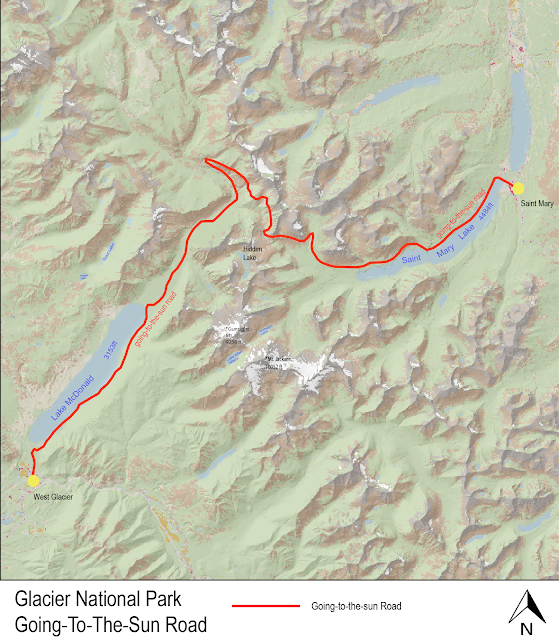
This is a map of Glacier National Park's Going-to-the-sun Road, minimal detail ensued, serves primarily as a demonstration of a work in progress towards a very detailed map.I'm not too fond of the current font, however setting a particular transparency percentage seems to allow arial font to blend with the map in a smooth way. Still toying with different settings on different color saturation backgrounds.
Minnesota Snowmobile Trails
The first assignment, this map was made to present the snowmobile trails that exist in the state of Minnesota, while simultaneously presenting lakes and streams as well as prevalent cities without drawing attention away from the intended purpose.
Subscribe to:
Posts (Atom)


